Sunday, January 29, 2012

Day 64-67 Destin to Panama City


The weather forecast was a mixed bag, the Admiral was concerned so I decided to single hand to Panama City and the Admiral rented a car to meet me there. The trip out of Destins East Passage was easy since I just followed the cookie crumbs on the chart plotter. And a Sport fisherman was heading out ahead so I took cues from him. Right away I got the head sail out and all looked good with 8-10 knot winds and calm seas.


The sail lasted 4 hours till I ran into a bit of rain and the wind died.


A bit of fog around so I fired up the Radar. But this is no big deal compared to fog in a restricted area like the ICW! I had 1/2 mile or more visibility the whole time from this point to the Panama Jetties.


As I was nearing the Panama Pass from the Gulf I paid close attention to the radar.


Well the fog lifted and the Pass was wide and easy with calm sea and almost no wind.


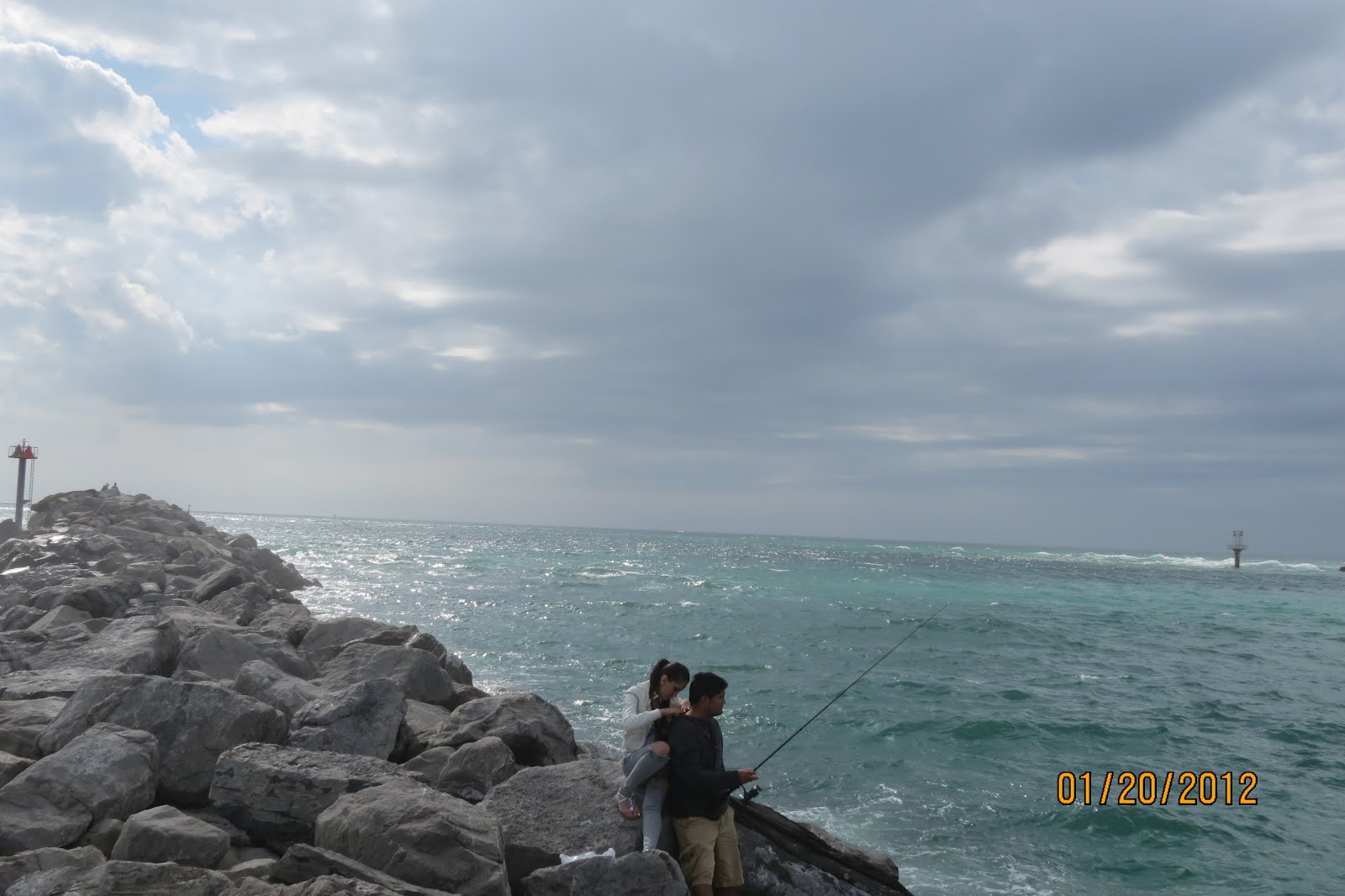
Not sure why they build the jetties so short?


Since we have a rent car we go straight to the beach the 2nd day. The beaches are lined with private hotel, condo or single homes just like Destin leaving very little access to the general public. We found this small public boardwalk sandwiched between buildings to get to the beach.


As you can see the beach is lined for miles with condos and hotels. Again NO trash anywhere. The beach sand is white but nothing like Destin's!
Notice, There are no public type people on the beach, just the people staying in the tall buildings.


This is a view from the opposite direction. Look it is all very private. No public access down there!


The Emerald Coast!


This is St. Andrews Bay looking out from the Panama City Municipal Marina towards the pass to the Gulf. We talked to some cruisers who are here to see family from the New Jersey. This was their destination and they will soon be heading back. They report this to be a great Sailing Bay.


We were assigned slip 12 near the end of this dock and little did we know how exposed we were to SouthEast winds and the fetch that could brew up from across the bay.


A front was forecasted to pass through Wed around 1700 and we had 2 foot chop hitting WS broadside + 30 knot winds. The square pilings are concrete and they eat dock lines.


The Break water that announces no wake is fake.


While the front was passing the Admiral hid out in the ships store. They do have a nice area to sit and pass time on the computer.


Walking around downtown Panama City we found this awesome soul food restaurant, we ate lunch there twice!


Here is the menu, it changes each day


We had a car so we could provision and we found the very nice Publix Grocery, but the Admiral wanted to go to a grocery in walking distance the next day to get a couple more things. Not sure why the grocery stores within walking distance to a marina are always the funky ones? Anyway she found what she wanted here.


We finally found some more cruisers in Panama city. We had a great time meeting the cruisers on 4 of these boats. From left to right, Kurt & Ann on Vidazzeled a Hunter 44, boat in the middle is Mike & Darlene on Etoile a 39' Mainship, then Folie a Deux a Ranger 46, then a C&C 38 centercockpit Final Destination headed to Alabama where they will live on the boat while their new home is being built.


Day 64-67 Destin to Panama City
Underway 8:32 hrs, 54.6 Nm., Avg speed 6.0 Kts. , 68-75 degrees, overcast 30% chance of rain 10-15 NE winds. Seas 0-1'


The Weather forecast was a bit dodgy so I consulted with a few local boat captains and they assured me it was good to go to Panama City in the Gulf, they said I might encounter a bit of rain but it would be just rain, no wind or storm conditions. The Admiral was not impressed so we decided that she would rent a car and meet me in Panama City, I would single hand. I did not want to spend 4 more days waiting for the next front to pass when we had this 1 day window to make the next port. The Admiral helped me off and she picked up a 1 way rent car to meet me at the docks to help tie up when I got there. She had a relaxing day driving down Hwy 98 and did not have to stress about being in the Gulf on a day like this, And I got to continue the dream.


The tide was an ebb tide, perfect for getting out the East Pass at Destin and luckily a big Sport fisherman was going out ahead of me so I pretty much followed him out. As soon as I made my turn South East I was thrilled to have a 10 knot NE wind and figured I would be able to sail all the way there. I turned up the Ipod and finally had what I felt this trip should be....I decided right then and there I would keep our mast. It turned into a Voodoo Child Sail. Click the link on the title of this blog for a youtube clip. The Excellent sailing lasted 4 hours then I noticed that I would soon be moving through some rain ahead. The Wind just died so I rolled up the sail and when I looked up...no rain?. Motor on so about 30 minutes later it did rain lightly, but the visibility was pretty good but I did crank up the radar. Hum, What is all that to the East? The radar was just full of it, it was a rain event going on over there near the coast. No problem all was good where I was. The sprinkling ended and then a bit of fog set in, but the visibility was not horrible and I was thankful it was NOT the ICW. I did keep an eye on the radar but I had plenty of time to react to whatever and I had not seen 1 vessel of any type the whole time. As I neared the jetties at the Panama City ship channel pass the fog lifted completely so no anxious moments at all. I am sure however had the Admiral made this trip it would be hard to convince her to go back out in the Gulf of Mexico again. It worked out perfect. She had a nice relaxing day and I had a great experience in the Gulf uping the learning curve. She met me on the docks and we got all squared away and took off for a Publix grocery store for some Admiral type of provisioning.


We were going to be here waiting out yet another front so we used the time with the car the next morning to see Panama Beach and go to the GYM! The Beach was like Destins, lined with private hotels, condos with hard to find public access. Destin definitely is the new standard for white sand, this beach sand did not measure up. After a long beach walk we headed to a nearby Golds Gym for a much needed body help. After we turned in the car we returned to the boat and got to meet several cruisers for the 1st time. Mike & Darlene on M/V Etoile a 39' Mainship trawler, Mark & Maridee on M/V Folix a Deux a Ranger 46, and Kurt and Ann on S/V Vidazzaled II a Hunter 44. We learned from Kurt that we were in the worst slip to be in when a front passes through and the concrete pilings would shred the dock lines. The very nice harbor master provided us with enough fire hose chafing gear to keep the lines protected and WS safe. Fortunately the front rolled in early about 1700 and we did not have to spend a rocky sleepless night aboard. The Admiral took her computer in to the ships store where there were a couple of nice tables for the cruisers to hang out and I hung out on the boat and the docks making sure everything was secure. I have never seen WS rock and roll so much in a slip, the SE fetch came right in the marina entrance and hit WS broadside, all the port side lines were stretched tight and she was a rocking. So if you come to the Panama City Municipal Marina take a slip as far back as possible. The wind backed around by 1900 and it was all over until midnight when the winds continued clocking till they were out of the North and all of a sudden we were pressed up against the dock. All the skippers had a brief dock party helping each other adjust the dock lines so we could all get back to bed. After all the lines were taken care of no one wanted to stay around and continue the party...those days are gone!


The next day we found Cassandra's and man I am talking Soul Food, Good ole southern cooking at it's best and $6.95 for all you can eat buffet. We ate there two days in a row for lunch. My grandmother lived there.


We checked out the local art museum and got a few more items at a little funky grocery store. I wondered why the grocery stores near marinas are the funky ones?


One of the things cruisers always do is compare notes on the weather and this helps calm all the Admirals moods so there is some general agreement on the best travel day. Our new friends would be traveling the ICW to Apalachicola but we would be going on the outside to Port St. Joe since again our 61' mast was to tall for the 50' bridges.


Monday, January 23, 2012

Day 57-63 Pensacola to Destin Harbor


Our first passage in the Gulf of Mexico, looks smooth out there doesn't it. Strange thing about taking pictures in a seaway, the pic never portrays the real sea conditions. Just out of the Pensacola Jetties we have 15-20 E winds and 3-4 seas with occasional 5's and one 8 after came out of nowhere. Very short wave period so it is choppy.


Here you can see the bow of the boat is higher than our heads and this is just a 4 footer.


Finally as we near Destin the winds turn South East so we some head sail out, the winds have calmed to 10-15 SE and 2-3' seas. The bow is no longer rising so high.


AHH! Land HO...Destin is nearing.


We were so busy navigating in to the East Pass that we did not have time for pics. We took these on a trip to the beach. The small rock Jetties are very short at the entrance. You can see waves breaking in over by the Green 3.


On rougher days the locals say the waves can be breaking across the entire mouth of the entrance.


There is shoaling near the Green 3 hence the waves breaking over there on that side. You can see the darker water over there so when you enter here you Hug the East Jetty, the one on the starboard or red side.


After clearing the jetties you look for the bridge and head for the center to stay in deep water making sure to keep the Green on the piling well to your port side.


These 50' bridges are why we have to go n the outside for this portion of the trip. Locals advise you to get very close to the bridge before making a hard right turn to starboard for the approach to the little bitty channel that leads into Destin Harbor.


So you stay Parallel to the bridge and come all the way to the Habor Walk Marina.


This is the Harbor Walk Hotel & Marina, easy to find and a great place to hang out for a couple of days.


After you make the turn to Starboard at Harbor Walk, you can finally see this very narrow channel. The sand bar on the right can make you a bit nervous bu the Admiral went up on the bow t take a look and she told me it was plenty deep close to the sand. Thankfully we did not meet another vessel here. The locals say there is plenty of room to pass but I think I would keep some fenders out on the port side Just in case?


As you see here, the distance from the outer most pilings of the Harbor Walk Marina are pretty close to the sand on the other side of the narrow channel.


Here is a relatively small vessel coming in through the channel. So you can see if you were in the channel and had to pass one of the many 60' or larger Sport fisherman in the area it could get dicey.


Just a pic looking out of the East Pass from Harbor Walk.


It was about a 2 mile+ walk to get to the beach but you want to be sure to see the Whitest beach sand in the world.


The water near the beach is a very clear emerald color and father out is a very clear blue.


It was a cloudy day around 65 -70 degrees
a great day to go down to the jetty and see it all up close.

Not 1 bit of trash on these Destin beaches, of course most of it is private, lined with rows of condo development, some private homes and very few hotels. We had to look hard for a access point to get to the beach.


The Admiral is always happy on the beach, she says she still likes Port A better. She has her binoculars and camera handy for all the local birds.


We had a great lunch at Harbor Docks Restaurant over looking the Destin Harbor.


WS at the Harbor Docks Marina, it is just a small marina with fixed docks, Water, elec, and WiFi. Big Sport fishing boats dominate this area.


Every day you can get a great Sunset in Florida, if you can see the sun!


The sea conditions would have made for a nice trip except for the forecasted am fog. This fog stayed the entire day in this harbor.


I consulted with the crew of the Lady Em, a charter Sport fisherman just next door to get some local knowledge since we would be leaving most likely on a low tide, so due to the shallow waters, and currents near the itty bitty Harbor channel I wanted to know what to expect and if we could even get out at our planned departure time.


Day, 57-63


Underway 9:01 hrs, 55.4 Nm., Avg speed 6.1 Kts. , 32-60 degrees, Sunny 10-15 NE winds. Seas 2-4.


Initially I wanted to make this not only our first passage on the outside but also our first overnight as well. After reading about Destin I just wanted to avoid navigating the East Pass and the small channel entrance to Destin Harbor. I thought it would be easier to just go on to Panama City. I overlooked however my first rule with the Admiral and to take all this in small steps. The concern with just going out into the Gulf was a big enough step without throwing in the overnight passage. As luck would have it a diver who we had survey our bottom in Pensacola introduced us to Captain Cook who we were able to meet with for about an hour and go over the charts for our several next destinations. He provided the local knowledge for us to get in at Destin so I was good to go and the Admiral was much happier taking just another small step. We again got out early as this would be a long trip. The 3-4' short chop as we exited the Pensacola Jetties did have the Admiral's concern, to me it was great finally getting WS into the Gulf. The ride is never as pleasant however when you have to motor right into it as the East wind was square on the nose. The forecast was for the seas and wind to subside around 1100 to 10-15 ESE and 2-3 seas. And it did so. About 2 hours out our route turned a bit more east so we could put out some head sail and the ride improved.


Even armed with the proper local knowledge for entering the Destin East Pass, I was using all my skills. I had the binoculars out early to find the sea bouy and then the 1. I adjusted our approach for a better angle to the mouth of the Jetties where you need to stay well to the red side and hug the East Jetty coming in. One thing the locals repeat is to do all this slow. I was concerned I may not have been far enough over but the depth was good. The approach toward the center of the bridge was easy enough since we were in much calmer waters but the flood tide was providing a bit of current. As I made the turn to starboard to run parallel with the bridge the current continued to take us toward the bridge, a little more RPMs and proper steering solved this. You are not able to see the small Harbor channel till you make the last turn and even then you question if what you are seeing is even a channel. The Admiral went up on the bow to watch for depth in the crystal clear water. She tole me there was plenty of depth all the way up to the little sand bar on the right side of the Channel. I was just hoping that we would not meet another vessel coming out since I definitely was taking my half out of the middle.


All is well, we were the only vessel moving about and we found the exact location of our Harbor Docks Marina with the Ipad Navionics. A quick call to the Harbor Master who is the Bartender at the restaurant and she gave us a choice of slip 12 or the L Head. We could not see any power on the L head so we took the slip.


The next day we walked to the beach. This is a great activity for the 1st day since anytime on the beach helps to get you into the groove of the destination. We had trouble finding a way to get on the beach since it is lined with private high rise condo's and some private homes. We finally found a small walkway which looked like it was constructed for those who lived across the street. The beaches are hard to access by the general public so no wonder there is absolutely no trash at all, I mean NONE on the beach. The Sand is incredibly white as it is reported that the unique sand of the beaches in the Destin area is among the whitest and most homogeneous of the world.Consisting of small quartz particles, this sand came from a process involving the Appalachian Mountains and the Apalachicola River 20,000 years ago. Click the title of this blog for a link to the complete description.


Everything you need is within walking distance so we did some provisioning 1 day and 2 days we hung out at Harbor Walk, we heard a some great music by a band called Hot Lava who played Bob James type Jazz...very cool. And watched all the Baltimore fans at a bar there become so hopeful and then leave so sad and rejected. We are now just trying to find a weather window to exit. There is some very weird weather around that is producing just enough rain of fog to find an exit difficult. After I post this I will see if there is any chance for tomorrow. We just need three more good travel days to get to our next long term destination which is either Apalachicola or Carrabelle.

Saturday, January 21, 2012

A Few Begining Cruising Notes

There are just a few things I want to document that are notable.


For whatever reason our engine is running 10 degrees cooler than it ever has. Diesel engines like to run and hate to sit idle. Especially marine engines. I am sure that whatever stuff that was built up in the heat exchanger and other cooling arteries have been flushed out. Before, whenever we ran at 1800 rpm's the temp was 180 and when pushed up to 2200 rpm's or higher the temp would rise to 190-195. Now it stays a constant 175 at 1800 rpm and if we are running higher rpm's it never exceeds 180 degrees. The engine also Sounds different.

You get used to your boat noises whether it's engine or just the creaks when running in a seaway. All the noises change a bit and become something new. We always investigate new noise to make sure all is good. Just consider it cruising noises after you are sure you know the source.

Boat Maintenance is almost as easy when cruising. We have been able to find a West Marine or Hardware store whenever we needed. Here in Destin there is one just a few blocks walking distance from our little marina. Routine inspection of the engine and running gear is essential for safety and peace of mind. It is impossible to carry spares for everything.


We of course read, listen and learn from cruising guides, and electronic sources but the most valuable information comes from the locals. It is important to get out and talk to others like the sport fishing captains who have local knowledge. You can also call the Towboat US in the area to get the information needed to navigate safely in and out of tricky spots.

You get a lot of advice from those who have gone before you and they may insist that you go to a certain anchorages, marinas, or destination, or avoid certain ones. Suffice it to say that every journey is different mostly depending on ones, cruising budget, WEATHER, and interest. Also you just can't see it all. You have to pass up a lot of great places, you just can't do it all. So as in the Ricky Nelson song, "You can't please everyone so you just have to please yourself".

The time zones Changes expectantly.

Pack only the healthiest food on the boat, you will have plenty of opportunities for the other stuff along the way.

Visibility is always a concern while underway, keep a good pair of binoculars handy. Some vessels like the large power boats have fly bridges so they can often see you before you see them. The other guy reads your intentions by determining where your bow is pointed. Best practice is to announce your intentions early so there is timely communication between vessels. On one occasion in the ICW on our trip to Pensacola I saw in the distance a motor vessel, I was a bit on the left side of the channel so I began to make my way to starboard to properly announce my attentions to pass on the "1". Even though it was nearly 10 minutes before we passed each other I think he was upset due to his rude behavior as we passed each other. Everyone has a different tolerance level.

I thought we had a good idea of what the cruising budget would be like. 2 things are much different from what I expected. First, the rule evidently for sailboats is that when cruising the wind will either be right on the nose or non-existent. Be sure to buy a boat with a really good engine. Secondly, even though you are going to an area where the temperatures are supposed to be warmer, it is not. On the nice days you are traveling, on the cold front days you seek a marina so you can plug in to deal with the 30 degree morning temps and or have a safe mooring for the frontal passage. So allow more money for fuel and Marinas. For us it means eating on the boat with just occasional meals out.

We took advantage of all the electronic sources for navigation. We updated the charts on our Garmin chart plotter in the cockpit, our portable Garmin (it is old but Garmin still produces updates). We have Navionics Chart plotting apps on our IPAD and the Admirals Iphone. We did buy some spiral bound chart books for the Florida Coast but these are the Admirals domain, I never use them. She likes to have them in the cockpit and make notes on them along the way. Instead I use free Seaclear II software and download free current NOAA marine raster charts. So I have on my little laptop all the charts for Texas, Louisiana, and Florida. We would not have the room to store so many paper charts on this boat. The SeaClear software is easy to use and I use it for all route planning. Also if I can get a local person on board I can easily access the chart and discuss details with them. Other sources include our Southern Waterways and Skipper Bob cruising guides. Then the latest in electronic cruising guides is Active Captain which is available with the Navimatics Navigation app for the IPAD or Iphone. The website is http://www.captainrated.com/ . Active Captain is a site where member captains contribute local/current knowledge so the information is relatively fresh. They promote participation by giving points to contributors and when you get a certain number of points they send you free stuff. But without the free stuff users are aware of how they can help others and they reap the benefits of others contributions. pretty sure this will replace book type cruising guides in the not to distant future.


Be careful taking navigational short cuts. Often when route planning or just when underway you look at the chart and see that you might save some time & fuel by taking a more direct line rather than stay in a marked channel. Study the charts three times to make sure you see everything, if using electronic charts zoom both in and out since the electronic chart offers different levels of data at different zoom levels. Another part of this task is AIS. If your chart plotter is also the AIS display then it is wise to leave the display zoomed out to see the AIS targets early. At the Zoomed out position you may be missing some navigational data that are important. So it is necessary to consistently adjust the zoom to insure you are seeing all the data to travel safely.


Weather is the primary concern. We consult several weather forcast sources but the one that rules the travel decision is the NOAA Marine Forcast. It is good to have a National picture so you can predict how long you may be staying at a given location, but as you know weather forcasting is really only good 24-48 hours out. Below is an example of the NOAA report we like the best since it gives the forcast for the sea conditions up to 20 miles out. The NOAA website has several features and is is important to learn how to navigate the site to get the information you need. It is not a real user friendly site, you need to click on everything and figure out how to get what you want. The Admiral is the Weather Bug on this vessel and she has it all down.


http://weather.noaa.gov/cgi-bin/fmtbltn.pl?file=forecasts/marine/coastal/gm/gmz750.txt

I wonder what all the above will be like 1 year from now. Technology is really changing everything, the one thing it is unable to change today however is the weather and that certainly dominates the cruisers decisions. We would have left Destin today but the forecast called for am fog. I stuck my head out at 0800 this morning and you can't see 10 feet.

Friday, January 20, 2012

Homeport Marina to Pensacola Palafox Harbour


The Admiral says she can't see as well as she used to but she never misses a raptor at the top of some far away tree.


The ICW soons changes to white sandy beaches.


On Both Sides of the ICW


This is the Pensacola Channel out to the Gulf from where we will soon be transiting to Destin, FL.


You go right by Fort Pickens.


This strange ship with this strange appendage was right next to our marina in Pensacola.


I had to find out what this strange ship does, the name is Global 1200.


Turns out it is the latest technology in deep sea pipe laying.


And this Tall Ship "Peacemaker" was moored near as well. Some group called the "Twelve Tribes" operates this ship and they allowed anyone to come aboard and take a self tour of the boat for a donation. They normally sail the East coast but comes to Pensacola once each year for a couple of months. I guess the twelve tribes are doing well, it would take a lot of orginization to raise the funds for a ship like this, not sure if they are a religious cult or something like the Amish? Wikipedia details some of their sketchy past but they seem to have their mission sustainable now. Anyway click on the title to this blog for a link to the ships website.


This is Seville Harbour where I thought we had reservations but when we called as we were approaching Pensacola we arbour instead, just around the corner and owned by the same Marina company. Seville was under repair and not accepting transients.


This is Palafax Street leading to the water front and our Marina.


WS at this 5 star Marina. The small boats in this marina were worth 15 times WS. There were several small private ships moored here.


This little Snowy Egret stayed around our boat fishing every day.


This is the entrance to Palafox Harbour, very hard to see from the bay until you get right up to it.


Jaco's is the very popular resturant on the right, I think the Marina owns it to.


A sunset over Pensacola Bay


We rented a car for a day and drove over to Pensacola Beach, The water is getting pretty clear and the sands much whiter.


We love our Mustang Island but these beaches are pretty incredible.


To cold to jump in the water but it was a great evening walk.


A Pensacola Sunset shot through the fishing pier.


Day, 53
Underway 4:40 hrs, 28.7 Nm., Avg speed 5.8Kts. , 32-60 degrees,Sunny 10-15 NE winds.


Man I was feeling pretty High as we departed Homeport and motored down this last stretch of the ICW that we would see for a while. I anticipated the trip across Pensacola Bay where I had come in from across the Gulf as crew for Wave Dancer ours friends Bill and Pam's 42' Passport.

What I did not anticipate was the shores of the ICW turning to white sand where the homes that were built along this section had a beach for their back yard. Still a couple of Tows moving about but I think we only saw two. Now we saw a lot more pleasure craft and several marinas along the way. As we approached Pensacola Bay we called Seville Harbor to let them know we would be arriving soon. The Lady who answered informed us that the person who took our reservation was a substitute and Seville was closed to transients. We would be going to Palafox instead. Hey the price was right since they took a boat US discount, just like Homeport Marina. This Boat US membership is finally starting to pay us back some. We were instructed to tie up at the fuel dock and Harbour Master Drew would give us a slip assignment. I thought this is a neat trick to get incoming transients to the fuel dock to buy fuel. Well I always like to top off the tanks anyway and come to find out their diesel was very reasonable and guess what, yep Boat US discount on the fuel also. It was blowing 15-20 and we were sort of pinned against the fuel dock with our high free board but Drew came through for us as he had the strength to push off the dock just enough for us to get away to our slip.

The Marina is located near downtown and three different Historic zones in walking distance. We also found a Greek Grocery store we could walk to to get some provisions. We did the nearby museums and had a great Happy hour right down on Palafox street at a winebar where the Happy hour was a carafe of your choice of wine for the price of a glass. We ordered the Shrimp Topas to share and it was great with the Sonoma Chardonnay.


Enterprise is our goto rental agency for cars since they come get you and they take you back after dropping off the car. We got a car for 1 day to complete our provisioning and to take an afternoon to go to Pensacola Beach. We were impressed with the blue water and white sands. The Admiral has been reading ahead and told me that Destin Beaches are supposed to be much better. I thought it would be hard to beat these beaches anywhere in the US but I am always ready for better. We ended staying in Pensacola for 4 nights while waiting for a front to pass through and to plan for our 1st passage on the outside in the Gulf of Mexico. The Admiral felt like we were missing something and was very concerned about going out into the Gulf. I scheduled diver to come and check out our keel and rudder since we had run aground twice in the ICW, once in Texas and once just after entering Louisiana. You want to be sure everything is ok before heading out into the Gulf of Mexico. The diver gave us a clean bill of health, all below the water line was ok, no damage. We asked him about the entrance to Destin and he said it was pretty straight forward but he said Captain Cook was on a boat right next to us and he made trips up and down the Florida coast all the time. The Admiral went right over and arranged for him to come meet with us and go over the charts for our next several destinations. Captain Cook spent about an hour with us and provided all the local knowledge we would need to navigate to our next four destinations. The Admiral was much relieved as we made final preparations to secure the boat for our 1st journey out into the Gulf for our passage to Destin where the entrance can be tricky without local knowledge.