A Early Earth Day on Whidbey Island
The Admiral has been planning a visit to Whidbey Island for weeks. Weather and other Seattle family activities seemed to fill the calendar. But at last the Winterspring appeared to be finally ending and a fine sunny Spring day was on the horizon. The Admiral got into high planning gear and wrote over three pages of stuff to do on Whidbey Island from internet searches. She refined her plan for several days and came up with the following itinerary which we actually were able to complete by 7pm and then take a easy drive back to Seattle, home by 8:45 pm. She had us up by 6 am and out the door by 7. No problem heading North on I-5 but the Southbound was a slow moving parking lot that extended all the way to Everett, WA. Unbelievable commute that nearly 300,000 cars trucks and buses make daily. Don't think about it, it could ruin your Earth Day! Easy to forget once you get to the Mulkiteo Ferry Landing. There was a heavy fog on the Sound when we got to the ferry parking lot but by the time we boarded it had all dissipated. It is a short 25 minute hop to Clinton. We did not dally in Clinton, We drove straight to Langly.
Langley and the Port of South Whidbey
http://www.langleywa.org/visitors/harbor_at_langley.php
We are planning a shake down cruise around the Sound and two Whidbey Island ports are on the Itinerary. So of course I wanted to make sure we at least got to make short stops and check out the marinas along the way. Langley is a pleasant surprise. It is a small community with about a 3 block long quaint main street just up the hill from the marina. Two days here by boat will be great.
 |
| The Port of South Whidbey at Langley is a small marina but evidently it gets pretty busy in the summer as they try not to turn anyone away and just raft later boats up to the ones already moored. |
 |
| This ocean going tug has it's own dock at the Port. I had a friend in Florida, John who spent his life on one of these as an engineer and literally traveled the planet. |
 |
| They recently added an outer dock to serve more transient vessels. |
Earth Sanctuary
https://www.earthsanctuary.org/
When we first moved to Seattle and started taking day trips you of course encounter the Puget Sound light houses. I thought then that I might get a list of them and sort of check them off the list eventually. I no longer am interested in that list, instead I am more interested in finding all the Labyrinths in the area and walking them. We walked one on Orcas Island and I really did not get it but walked it anyway. But after three visits to the Labyrinth on Bainbridge Island:
https://www.wta.org/go-hiking/trip-reports/trip_report.2015-05-28.7585165232
I am starting to get it. The Admiral is a long time yogi and has recently taught me some of the Kundalini Yoga chants she uses in her classes. After a few visits to the Bainbridge Island Labyrinth at Hall Hill and chanting while turning the prayer wheel as well as during meditation there, walking the Labyrinth was the icing on the cake, we always left there feeling very peaceful. Some of our everyday type of obstacles have also begun to disappear and now I realize that this is due directly to these experiences.
So the Earth Sanctuary on Whidbey Island was another way to connect directly with nature and continue to experience a sort of soul cleansing.
 |
| The offerings at the center of the Labrinith |
 |
| We did not have any tobacco so we left other organic offerings |
 |
Chanting
Ong Namo Guru Dev Namo
Brings nature in Crystal Clear
|
 |
| The best gongs bring together the best vibrations. |
 |
Dolmen Megalith
A dolmen is a megalith of upright stones supporting a large horizontal slab. Inspired by a dolmen at Carnac, France, the 20-ton Dolmen at Earth Sanctuary is the first dolmen to be built in the U.S. during modern times. It serves as a place for meditation and reflection where visitors can center themselves and discover an intense, unmistakable connection with the earth.
|
 |
| The bunny trail continues |
 |
Buddhist Stupa Monument, Mani Prayer Stone and Tibetan Prayer Wheels
Buddhist traditions of healing and enlightenment at the Buddhist Stupa monument, high on a hillside at Earth Sanctuary. A stupa is the most important Buddhist monument and sacred structure designed to bring peace and healing. The stupa at Earth Sanctuary was designed by architect Mathew Swett using what is believed to be the first 3D architectural model of a Tibetan Buddhist stupa.
|
Fort Casey
https://parks.state.wa.us/505/Fort-Casey
 |
Admiralty Inlet was considered so strategic to the defense of Puget Sound in the 1890s that three forts, Fort Casey on Whidbey Island, Fort Flagler on Marrowstone Island, and Fort Worden at Port Townsend, were built at the entrance with huge guns creating a "triangle of fire." This military strategy was built on the theory that the three fortresses would thwart any invasion attempt by sea.
|
 |
| Huge Bluffs with wide rocky beaches below shaped by the weather of the San Juan De Fuca |
 |
| With record Pacific Northwest rains comes record logs and trees down the numerous river systems out into the Salish Sea and the rocky beaches. |
 |
| The Ferry to Port Townsend directly across Admiralty Inlet |
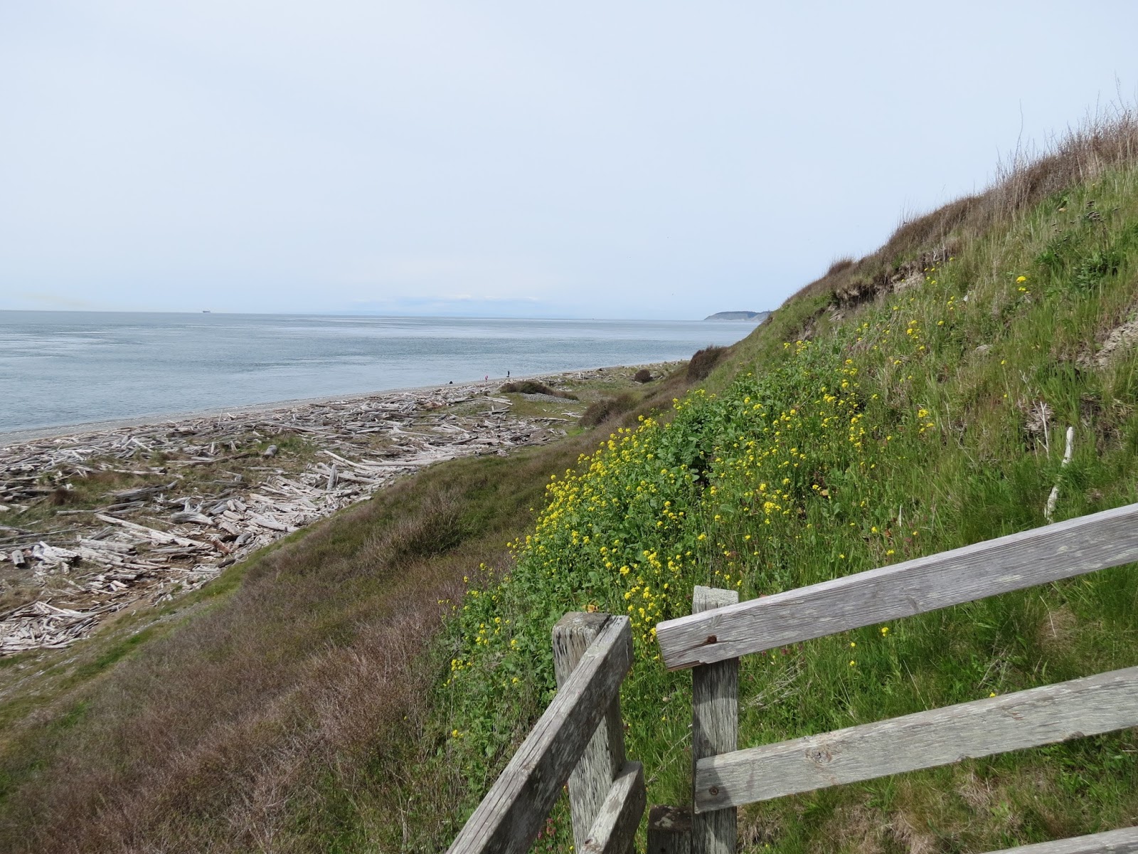
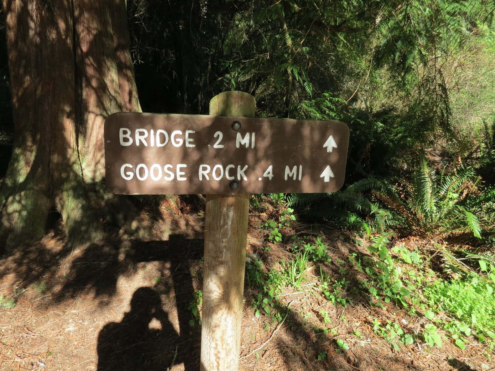
Eby's Landing
https://www.wta.org/go-hiking/hikes/ebeys-landing
The Reserve at Ebey's Landing provides a vivid historical record of Pacific Northwest history, including the first exploration of Puget Sound by Captain George Vancouver in 1792; early settlement by Colonel Isaac Ebey; growth and settlement resulting from the Oregon Trail and the Westward migration; the Donation Land Laws (1850–1855); and the continued growth and settlement of the town of Coupeville.
 |
| This ambassador was greeting those who entered the trail. |
 |
| These and other yellow blooms were sprinkled all along the trail |
 |
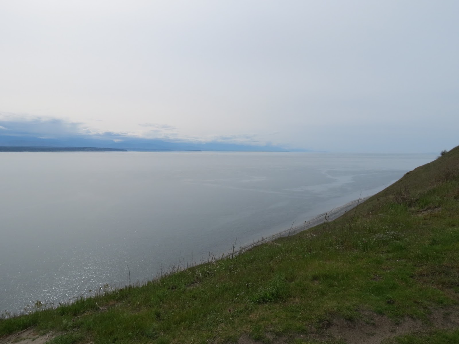
| Views straight out the Straight of Juan De Fuca to the Pacific Ocean with BC, Canada Vancouver Island on the North shore of the strait and the North end of the Olympic Peninsula on the South Shore. |
 |
| Protection Island is an island located in the Strait of Juan de Fuca just north of Discovery Bay in northeastern Jefferson County, Washington, United States. The island has a land area of 1.534 km2 (379.11 acres). It is a federally protected National Wildlife Refuge; boats are not permitted within 200 yards (183 m) for the safety and health of wildlife on and near the shores. There is only one individual still living on the island not associated with the government, an inholder named Marty Bluewater who has lifetime use of his cabin on the island's southern bluffs.[1] The island also houses a caretaker, a volunteer hired by the Fish and Wildlife department to watch over the island, and take care of its many inhabitants |
Oak Harbor
is Whidbey Island's largest incorporated city. Named for the Garry Oak trees which grace its skyline. The city's growth coincided with two major events: the building of Deception Pass Bridge on July 31, 1935, and the completion of Naval Air Station Whidbey Island on September 21, 1942. Oak Harbor's history goes back to the early 1850s, when two settlers staked claims where the city now stands—Zakarias Toftezen, a shoemaker from Norway; C.W. Sumner from New England
http://ohmarina.org/
 |
Oak Harbor Marina
This marina is on our June Itinerary so of course I wanted to stop in and check it out. |
 |
| Always good to see things at Low Tide |
 |
| This marina was built in 1974 but it looks a bit saltier than that. |
 |
| The extra long gangway provides a easier slope at low tide. |
 |
| Guarantee you there are some salty characters around here. |
 |
| Love the name Como Nova, say it real fast. |
 |
| This is an exact replica of Josh Slocum's vessel "Spray". I saw this vessel and the Captain at the Center for Wooden Boats a year or so ago when Joshua Slocum's Granddaughter was giving a talk there. |
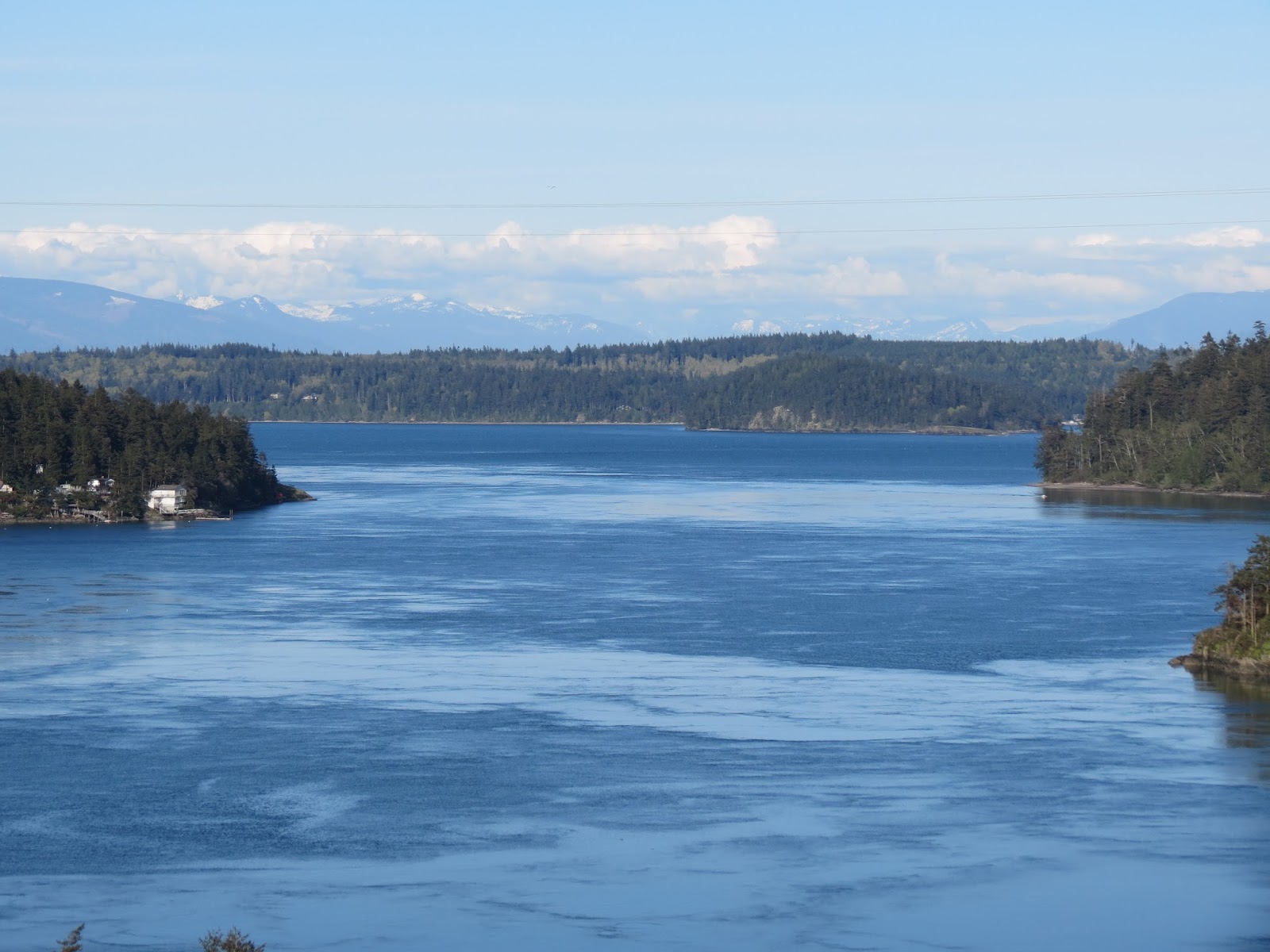
Deception Pass
is a strait separating Whidbey Island from Fidalgo Island, in the northwest part of the U.S. state of Washington. It connects Skagit Bay, part of Puget Sound, with the Strait of Juan de Fuca. A pair of bridges known collectively as Deception Pass Bridge cross Deception Pass, and the bridges are on the National Register of Historic Places.
The Deception Pass area has been home to various Coast Salish tribes for thousands of years. The first Europeans to see Deception Pass were members of the 1790 expedition of Manuel Quimper on the Princesa Real. The Spanish gave it the name Boca de Flon.[1] A group of sailors led by Joseph Whidbey, part of the Vancouver Expedition, found and mapped Deception Pass on June 7, 1792.[2] George Vancouver gave it the name "Deception" because it had misled him into thinking Whidbey Island was a peninsula.[3] The "deception" was heightened due to Whidbey's failure to find the strait at first. In May 1792, Vancouver was anchored near the southern end of Whidbey Island. He sent Joseph Whidbey to explore the waters east of Whidbey Island, now known as Saratoga Passage, using small boats. Whidbey reached the northern end of Saratoga Passage and explored eastward into Skagit Bay, which is shallow and difficult to navigate. He returned south to rejoin Vancouver without having found Deception Pass. It appeared that Skagit Bay was a dead-end and that Whidbey Island and Fidalgo Island were a long peninsula attached to the mainland. In June the expedition sailed north along the west coast of Whidbey Island. Vancouver sent Joseph Whidbey to explore inlets leading to the east. The first inlet turned out to be a "very narrow and intricate channel, which...abounded with rocks above and beneath the surface of the water".[4] This channel led to Skagit Bay, thus separating Whidbey Island from the mainland. Vancouver apparently felt he and Joseph Whidbey had been deceived by the tricky strait. Vancouver wrote of Whidbey's efforts: "This determined [the shore they had been exploring] to be an island, which, in consequence of Mr. Whidbey’s circumnavigation, I distinguished by the name of Whidbey’s Island: and this northern pass, leading into [Skagit Bay], Deception Passage"
https://parks.state.wa.us/497/Deception-Pass
 |
| Looking West with Deception Island in the center. |
 |
| We could have taken the car up to the bridge but the Admiral wanted to hike it. |
 |
| Everything that goes up has to come back down and everything that goes down has to come back up in most parts of Western Washington. |
 |
| Almost to the Bridge. |
 |
| The Admiral elected to take the Summit trail up to Goose Rock, the highest point on Whidby Island, I had enough up's for the day so I strolled down the perimeter trail with much less up's. |
 |
| The Admiral standing on Goose Rock |
 |
| Looking East off the Bridge, Strawberry Island in the center. |
 |
| Looking East toward the Cascades from the bridge. |
 |
| Looking West from the bridge with Deception Island on the right. |
 |
Deception Island
In between Fidalgo Island and Whidbey Island is Deception Pass and Canoe Pass, and further out near the tips of these islands is the little tiny tree-covered rock of an island that is too small to be occupied by anyone. |
 |
| Down is good |
 |
| This vessel transiting the pass was motoring but the current had her going at least 8-9 knots for sure. when you are moving that fast due to current then you have very little steerage since you do not have adequate water flowing in the right direction around the rudder. All you can do is hope for the best! |
 |
| A sunset picnic dinner on the beach to close out our Whidby Island Earth Day. |
The Admiral knows how to MAX out a fun sun day. But if you just had time for a few things then we suggest The Earth Sanctuary, Eby's Landing and Deception Pass as must do's on Whidby Island.


