 |
| Seattle is known as the Emerald City but only West Seattle is still Emerald as you can see in the lower laft hand corner, they haven't cut down all their Emerald trees. |
 |
| The Port has a large foot print, the Island in the center is the Man mande Harbor Island, the Duwamish River is the waterway running South from the port. |
 |
| This is a snapshot from the Marinetraffic application on my Iphone. You can see the ships coming and going from the Pacific through the Strait of Juan De Fuca and head North to Canadian ports or South to Seattle and Tacoma. You can tap on the ship icons and get instant information regarding their navigation and destination and their Hailing port. You can go to www.marinetraffic.com to get the same on your computer.. |
 |
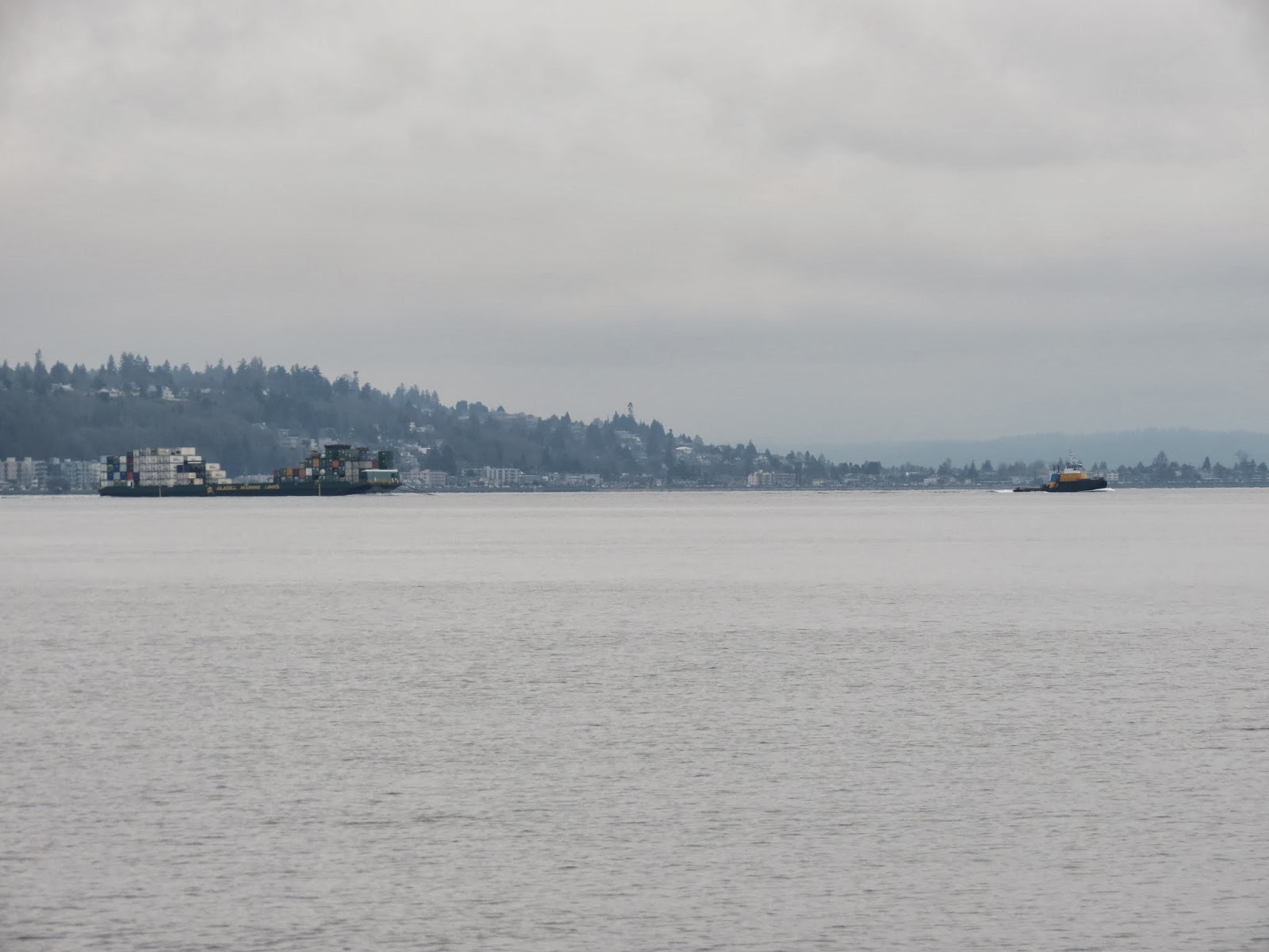
| Looking out of our Condo window you can see these behemoths sailing in almost everyday. |
 |
| All the West coast Ports are worried about their future with container ships since these big guys that carry 15,500 containers like the one above will be able to go through the new Panama Canal in 2015. Their hopes are riding on the new ultra Large ships that will carry 20,000 containers. All the Gulf of Mexico and East Ports are competing for the new business these guys will bring by upgrading bridges and port facilities. Corpus Christi has a new Bridge in the Works along with increased dredging of the Corpus Christi Ship Canal. |
 |
| We often walk along a hike and bike trail and get a close up of the Bulk Cargo ships loading up with Americana Grain. |
 |
| One Ship can hold the contents of about 9 of the silos. |
 |
| Just on the edge of Downtown |
 |
| Here you can see three identical Dry bulk cargo ships all from different countries anchored near the Grain silos just waiting their turn at the single dock. The last one in has about a 4 week wait, The crew won't be allowed ashore till they dock! |
 |
| Tugs pulling barges loaded with containers and all manner of other stuff never stop 24/7 |
 |
| The Coast Gurd keeps a watchful eye on Puget Sound 24/7 |
 |
| It appears someone converted a Workboat into a personal trawler for themselves. |
The Port of Seattle and the Duwamish River
Almost every day one or more Container Ships sail out of the
Pacific Ocean and into the Strait of Juan De Fuca entering Puget Sound to the
Port of Seattle. There are a lot more
that continue on to the Port of Tacoma or head North to several Canadian Ports
like Vancouver. Along with the container ships are also lots of other cargo
ships: dry bulk (grain), petro-chemical, automobiles, and every other product
that is bought and sold on the world markets. The Global Economy is right out
in front in Elliot Bay where, sitting from the vantage point of our grandsons’
home, I study this economic phenomena.
I use
http://www.marinetraffic.com
to track vessels and get information regarding their speed heading and
destination. It is about 140 NM.from the entrance of Strait of Juan De Fuca to
the Port of Seattle so a ship steaming at 22 knots can make this leg in less
than 7 hours (it would take a sailboat 24 hours+ to make the same trip
depending on currents). Of course it is easy to determine who owns the vessel
and go to the company websites to get ship specifications etc. A large portion
of the Port of Seattle is constructed on Harbor Island which is the largest Man
Made Island in the US and sits at the mouth of the Duwamish River.
All matter of shipping is interesting to me, I guess it is
just a by product of being a sailor and boat owner but since I am in the
position of sitting and watching the boats of all sizes come and go in Elliot
Bay for hours every morning while I care for our 5 month old grandson I
entertain myself by asking questions and searching for the answers. In Corpus
Christi we can easily see the Ship Canal about 3/4 mile North of our slip and
it is interesting to watch the ships come and go but since the Ship canal is
very limited to the amount of traffic it can manage and the Port is mostly out of sight, it just has never
stimulated the kind of interest that the Port of Seattle does. The Puget Sound
VTS (Vessel Traffic System) controls all the commercial vessels in Puget Sound
and publishes the rules for recreational boaters (which there are thousands and
thousands of in the Sound):
http://www.uscg.mil/d13/psvts/default.asp
The interest in the Port of Seattle also led to an interest
in the Duwamish River. It runs South of the port for miles and 6 of those miles
has lots of industrial companies that are spin-offs of the port, Maritime
business, Boeing Aircraft, and Industrial support for the City of Seattle
lining both banks. The Duwamish was declared a Superfund CleanUp site by the
federal Government in 1990's Superfund sites and their status can be found on
the EPA website
http://www.epa.gov/superfund/sites/index.htm
, Check it out you can find the sites located near YOUR home. The Duwamish
River and the industry that lines it’s banks are integral to the Port of
Seattle so it is hard to separate the two whenever you are trying to learn a
bit of History, the present on goings, and a look to the future as well. The
good news is that The Port and the Industry located on the Duwamish have turned
the corner and are in the process of cleaning up the mess and planning on how
to mitigate a hundred years of pollution. All the Stake Holders
including the Duwamish Indians have signed on to the preliminary plan of saving
the industry along the Duwamish banks so that the economy and jobs do not take
a hit. They are not out to close down any business, just clean up the river in
a socially responsible way. Clinton ended the “Funds” in the Superfund so now
cleanup cost are to be born by the polluters and local government. Needless to
say there is not enough money right now to get the job done quickly so it is
forecasted to be a 40-50 year job to get the river and the water entering
Elliot Bay and Puget sound cleaned up to levels acceptable by the stakeholders.
The environmental consciousness here in the PNW is very
strong so I was very surprised that there was such a environmental disaster
anywhere near all this pristine looking water with all the forest and
mountains. They recycle everything here you barely have any household garbage
at all since it is so efficient. I am sure part of the problem is the
geography, everything runs down hill with the seasonal rains and large river
and stream tributary systems both natural and man made. I viewed several Youtube
videos on the Duwamish seen here:
http://www.youtube.com/results?search_query=duwamish%20river&sm=1
This one has some of the best video but it has a
anti-capitalist message, but so
what, it certainly will not change
capitalism!
I am most interested in the Container Ships and the Dry Bulk
Grain ships since they are the most obvious to my ship watching activities
About the Container Ships
You can find out how container ships work here http://www.pacificmarine.net/marine-deck/cargo-securing/how-do-container-ships-work.htm
by clicking the links on the page you get the details which anyone that crosses
an ocean might be interested in understanding since several container ships
have lost containers overboard and become a hazard to navigation, especially
someone sailing along on a fiberglass vessel. The containers float just beneath
the surface, sometimes with just a corner sticking up but invisible to a vessel
on a collision path. The Panama Canal will finish the expansion to allow Super
Ships through that can carry 14,500 containers. These are the ones that come
into Seattle now because they cannot fit through the Panama Canal. All the Gulf
of Mexico and East Coast ports are anticipating the new larger container ships
into their ports once the expansion is completed in 2015. So Seattle and the
State of Washington is in a mad rush to upgrade the road and train systems that
carry the containers across the nation so they can handle the new Ultra Large
Container ships that will carry 20,000 containers but will not fit through the
new Panama canal. The Port can off load 15,000 containers and send the ship
back for more in less than 2 days. The current large container ships are just
over 300 meters or 984 feet in length.
Bulk Cargo Grain Ships and the Grain Silo
Just to compare how much grain a ship like this can carry a 60' in length train
box car can hold up to 143 tons fully loaded so the ship can hold the
equivalent of 707 box cars, imagine a train 707 cars long. A Semi truck Depending
on the size of the trailer and the commodity,1000 to *1200 bushels or 60 to 70
thousand lbs is a good average so the ship can carry the equivalent of about
2,799 semi truck loads of grain, think about that Highway! Based on 50 pounds
per bushel of grain it would take around 58,000 acres to produce the grain for
one of these ships, take that to the Bank! The United States is truly the
world’s bread Basket .Shortly after we arrived here in August these ships
started rolling in and have been nonstop for the last 4 months. It takes about
6 days to load a ship and send it on it’s way. There are always 1-4 ships
anchored just off a few hundred yards waiting their turn at the single berth.
Trains pour in from all over the mid-west to Seattle and off load at the grain
silo. Wheat, corn, and who knows what other grains? All the figures above are
subject to the type of grain/weight and the actual yield per acre of any given year
but I think you get the picture, these are huge ships and we sell incredible
amounts of grain to the world. I am guessing we have seen about 21 ships come
and go from the Port of Seattle Terminal 86 and this is just one of several such terminals on the west coast.
I plan to find a way to travel up the Duwamish by boat in the near future so I will post that one when it gets done.
No comments:
Post a Comment